

DeKalb Releases Expansive Trail Network Plan
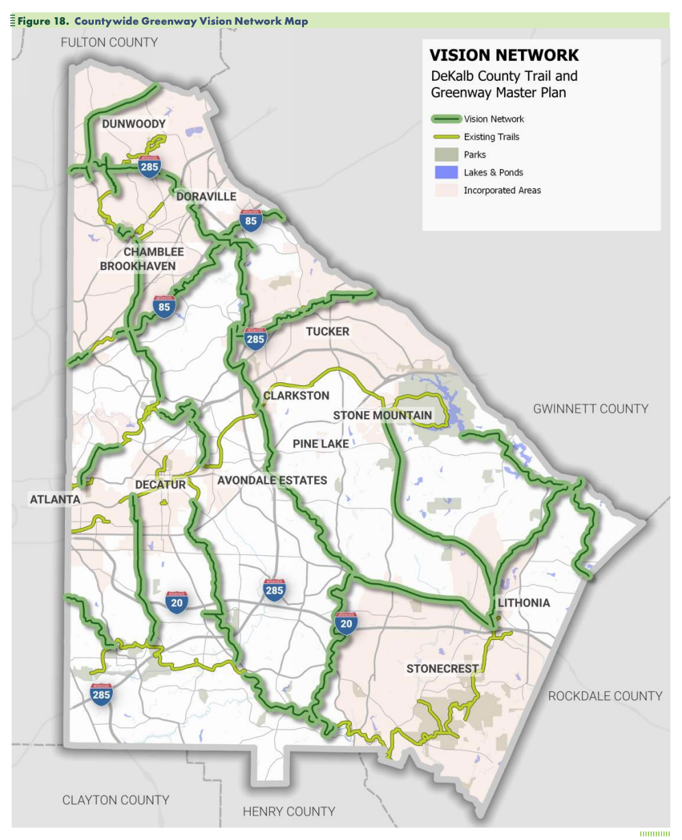
DeKalb County recently unveiled its “greenway” master plan, an ambitious 107-mile network of hard-surface trails connecting hikers and bikers from Lithonia to Dunwoody to Atlanta.
Little of the county’s proposal includes the South Fork of Peachtree Creek, although long stretches of the stream between Interstate 285 and Emory University are already lined with both hard and soft trails, sidewalks, and wooden walkways. And Tucker and Clarkston both plan miles of trails through their cities that will parallel the South Fork.
Still, the county’s proposed trail network would go a long way to stitching together unincorporated DeKalb with the incorporated towns and the city of Atlanta.
“DeKalb County is committed to creating a connected, safe, and accessible trail network,” says the master plan released January 24. “It seeks to provide a sustainable transportation option for all users, promote healthy living, and create a sense of community.”
The county’s plan calls for 65 new miles of trails across unincorporated DeKalb; cities within the county have built, or will build, an additional 42 miles.
Potential cost to the county: $212-262 million. Financing would likely come from a bevy of federal, state, county, and nonprofit sources. Construction would run through 2057.
DeKalb spent a couple of years, via open houses, walking tours, stakeholder interviews – including with the South Fork Conservancy—and on-line surveys, querying county residents on their trail preferences. While the Conservancy prefers soft-surface trails, the county’s greenways plan includes only paved or hard-surface trails, like the PATH Foundation’s Stone Mountain Trail that connects Stone Mountain Village with downtown Atlanta.
Even so, South Fork members were largely pleased with the county’s trail proposals. Board members hope to meet soon with DeKalb officials to further advocate for their trail-location preferences.
🔎 EXPLORE the information hub: https://www.dekalbgatrails.com/