


The Splash Report & More
Excerpts From Our Monthly Newsletter and Other News
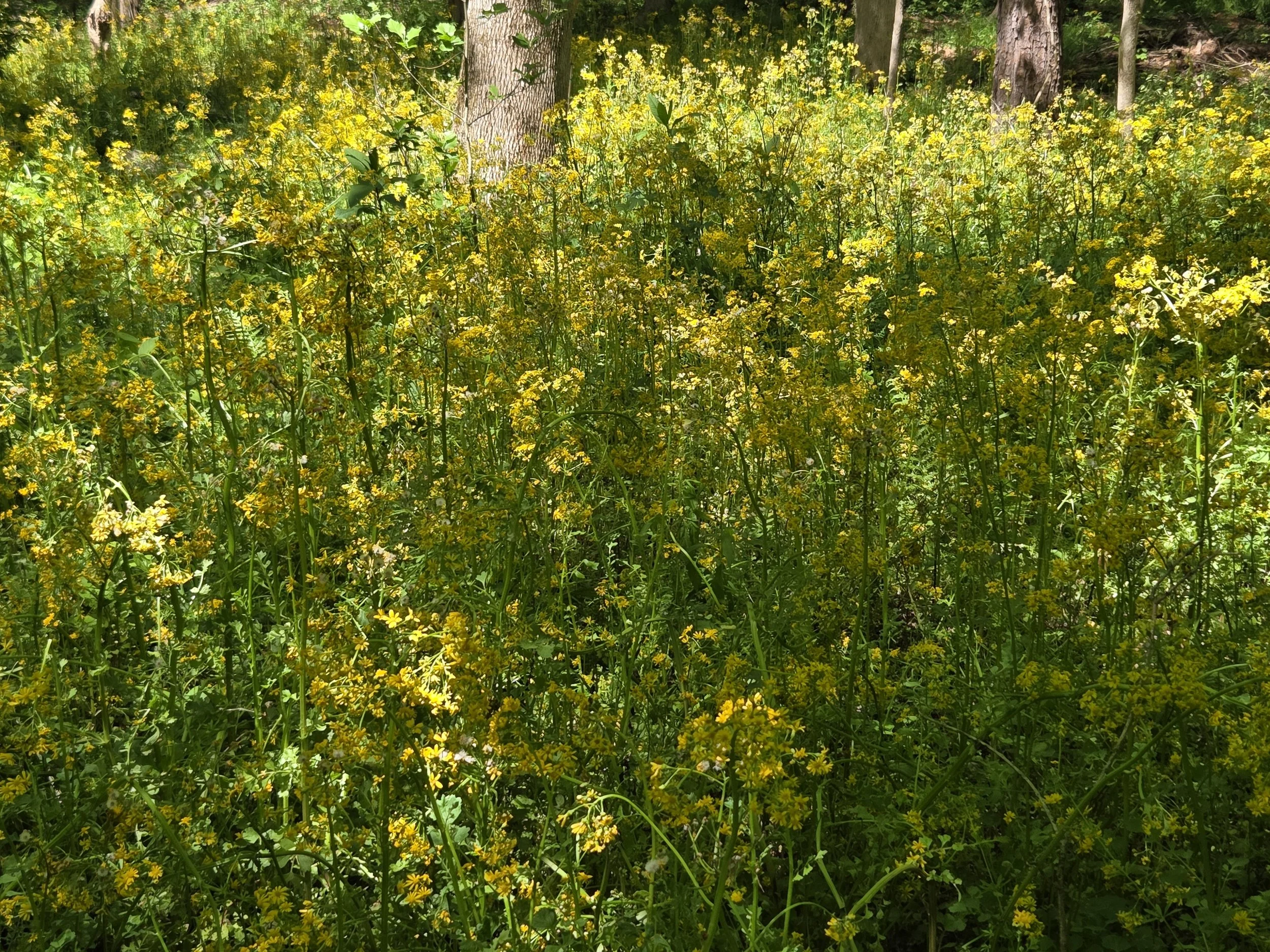
A Creek Runs Through It
Zonolite Park is a tranquil 13-acre area featuring an old-growth forest, sunny meadow, and a pond. The park has a mile and a half of gravel trails, 30 raised garden beds for community gardeners, and a new children’s playground creatively crafted from tree stumps. The South Fork of Peachtree Creek runs through it, and visitors can easily access its sandy banks where water-loving wildlife – birds, fish, frogs, and more – can be observed.
This natural beauty is quite remarkable considering it was transformed just about 15 years ago from a former asbestos-contaminated brownfield in an industrial park near the Morningside and Druid Hills neighborhoods. We spoke with Pete Densmore about how the volunteer “Friends” group he leads maintains and improves this urban park. Click the link to read how much work this group has done in partnership with DeKalb County to create a beautiful, nature-loving park and how you can get involved!

2026 City Nature Challenge
April 24-27: 2026 Atlanta City Nature Challenge, led locally by Fernbank Museum. Come with us to explore the forest at Montreal Park in Tucker with a naturalist. Or participate from anywhere!

A Message from Board Chair Jeff Rader
As the 2026 South Fork Board Chair, I’m proud to lead an organization that is changing to fulfill its mission to Conserve, Restore and Connect the Creek to many stakeholders! South Fork is expanding its efforts to respond to the needs of the watershed and the people who enjoy and depend upon it every day.
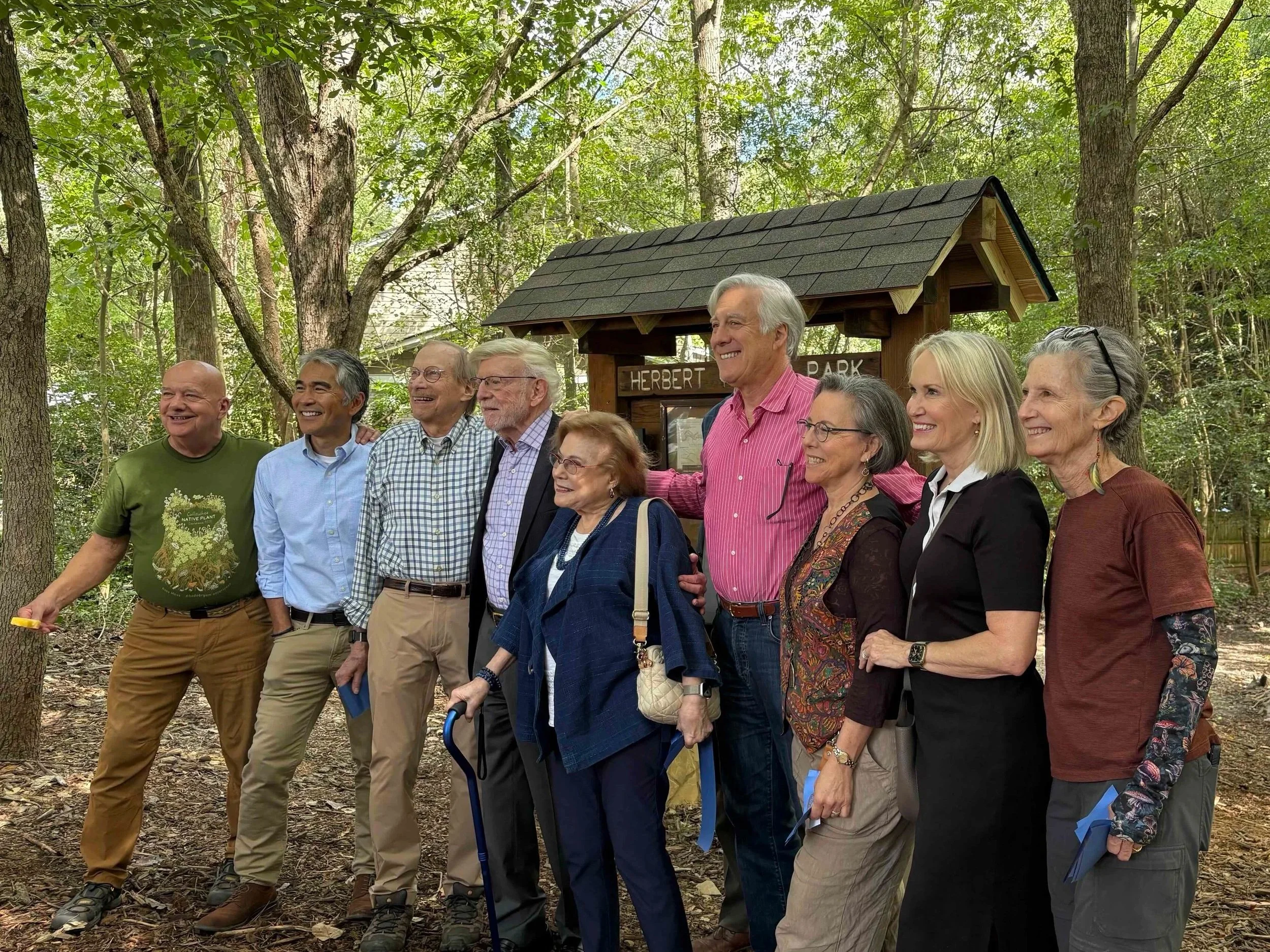
Friends Group Maintains Morningside Park Gem
The Friends of Herbert Taylor Park & Daniel Johnson Park is the organizational steward of two adjacent Atlanta city parks in Morningside comprising 39 acres and surrounding the areas where the South Fork of Peachtree Creek and Rock Creek flow through the neighborhood. Herbert Taylor Park, the largest parcel, was deeded to the city beginning in 1972, and enlarged over the years. Daniel Johnson Park, the smaller area, was transferred to Atlanta Parks by the Johnson family in the 1930s. It runs along Beech Valley Road.

SFC's Top Five Reads for 2025
Great reads this holiday season: Check out our top five picks for 2025. Read our reviews below.
Writer Georgann Eubanks invites us to join her and photographer Donna Campbell as they travel across seven southeastern states: Alabama, Georgia, Florida, North Carolina, South Carolina, Virginia, and Tennessee. Their purpose? To witness what she calls “common events that we had never experienced up close.” These events are “common” in that they happen every year in these places.
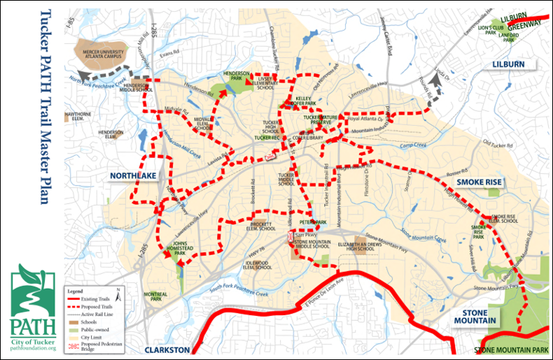
Tucker Plans Trails With South Fork Connection
The City of Tucker is well into the planning stages of a 32-mile series of trails that will connect its downtown with the South Fork. DeKalb County is expected to roll out its “comprehensive trail/greenway master plan” this summer with an assortment of possible connections to the South Fork. And the South Fork Conservancy, the nonprofit crafting trails and parks along the creek’s 32-mile run, recently created a committee dedicated to trail construction from Tucker to Emory University.
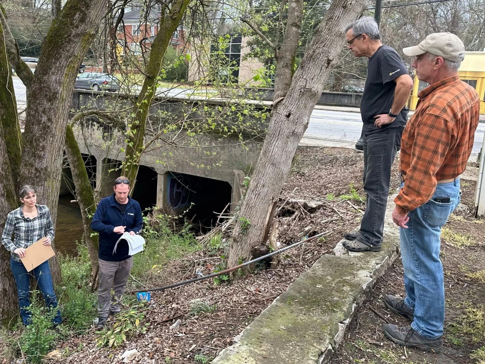
The Effort to Restore Emory Village’s Peavine Creekbank
With input from Druid Hills residents, the Conservancy came up with a plan to restore a portion of the creekbank to health so that Peavine becomes a natural amenity in the village and the crown jewel of the watershed that it serves. The plan calls for 1) stabilizing the creekbank in Emory Village near the Panera Restaurant to establish safe access for maintenance; 2) installing a trash trap and rain garden to slow down and absorb storm water; 3) planting native trees and plants; and 4) building an overlook so that people can appreciate the treasure that Peavine is.
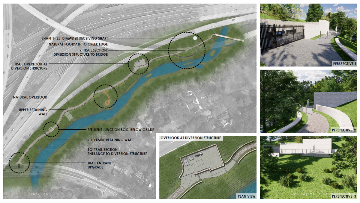
Stormwater Project at Cheshire Farm Trail Benefits Peachtree Creek
In late January, Atlanta’s Department of Watershed Management (DWM) broke ground on a massive $145 million stormwater diversion system along the North Fork of Peachtree Creek near I-85 and Lindbergh Drive. The system will hold up to 15 million gallons of combined runoff and raw sewage, so sewage won’t spill into and pollute the creek during heavy rains.