Confluence Bridge and and Trail Updates
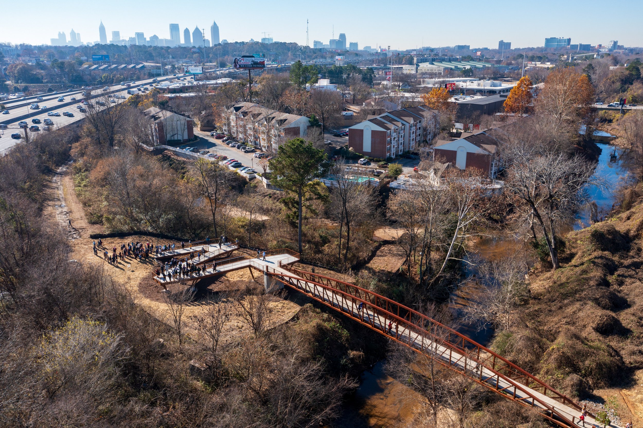
Confluence Bridge. Photo by Rob Knight of Buckhead.com
The Bridge
The Confluence – the site where the North and South Forks of Peachtree Creek meet – has immense historical value and natural beauty. Here, early Atlanta residents were baptized, Native Americans traded, and the long, rich natural history of Georgia's waterways has flourished. Now, a state-of-the-art installation provides a gateway to the Creek's beauty. This ADA-accessible bridge brings the South Fork to two neighborhoods that have been ranked by the Trust for Public Land as "High Need" for park access. The bridge will also provide a connecting trail to the Atlanta BeltLine, linking a series of urban parks in one fell swoop. Following the creation of new trails along other parts of the South Fork, even more high need neighborhoods will be connected to parks. This is more than a simple creek crossing: the bridge provides an entry point to the iconic waterways that have shaped our city for generations.
To support access and equitability, the bridge features an ADA-approved ramp, making sure as many people as possible can enjoy South Fork's trails. Photo by Rob Knight of Buckhead.com
The bridge is over 175-feet long and is made of Corten Steel. Photo by Rob Knight of Buckhead.com
The Trailhead
The intersection of three of South Fork Conservancy's nature paths – the Confluence, Beltline Connector, and Meadow Loop trails – forms a natural meeting place along Peachtree Creek. We’ve added educational signage to this spot, informing people about Peachtree Creek, the South Fork, and the role of these waterways in the development of Atlanta. Just as the Confluence Bridge formally connects outh Fork Conservancy trails to the Atlanta Beltline, the Confluence Trailhead will give people a gathering place to enjoy the creek.
Photo by Rob Knight of Buckhead.com
The Confluence: Why here?
The Confluence connects more than waterways – it links the South Fork with the Atlanta Beltline, PATH400 trail, and neighborhoods in park-starved areas of the city.
Map of metropolitan Atlanta trail systems, including selected parks and universities.
Thus far, South Fork’s trail system has existed within spitting distance of two of Atlanta’s major pedestrian and recreational arteries: the Beltline and the PATH400. These three trails – two paved, one dirt – have yet to connect in a single location. That’s why we built the Confluence Bridge.
Now, the South Fork’s natural richness will become an integral part of our city’s urban trails. Someday people will be able to walk from Emory to the edge of West Atlanta without ever having to leave a trail.
What is a park desert – and why does it matter?
The Trust for Public Land, a nonprofit that advocates for parks and public lands around the country, periodically releases “ParkScore,” a comprehensive rating system for how well cities meet their citizens’ park needs. Atlanta is currently ranked 43 out of a hundred (Minneapolis was ranked #1). We can do a lot better.
Our relatively low ranking indicates that about half of the city resides over a 10-minute walk (roughly equivalent to half a mile) from the nearest park. That 10-minute walk is an important number: beyond that, people become significantly less likely to make the walk and, subsequently, to be outside. Access to parks is vital, impacting a variety of human and environmental health needs in urban areas. Eliminating park deserts – areas without access to parks – is critical to developing livable cities.
Pictured above: The Confluence Bridge adds accessible green space in one of Atlanta’s park deserts. In the photo at left, the red square outlines the area where bridge allows access to green space. That area is expanded at right, where the trail, bridge, and Armand Park connect three neighborhoods labelled as “High Need” for park access by the Trust for Public Land.


